
Civil engineering has always been a field of innovation, from the earliest road-building techniques to modern-day mega-construction. In recent years, the sector has welcomed digital technology to improve the precision, speed, and overall execution of projects.
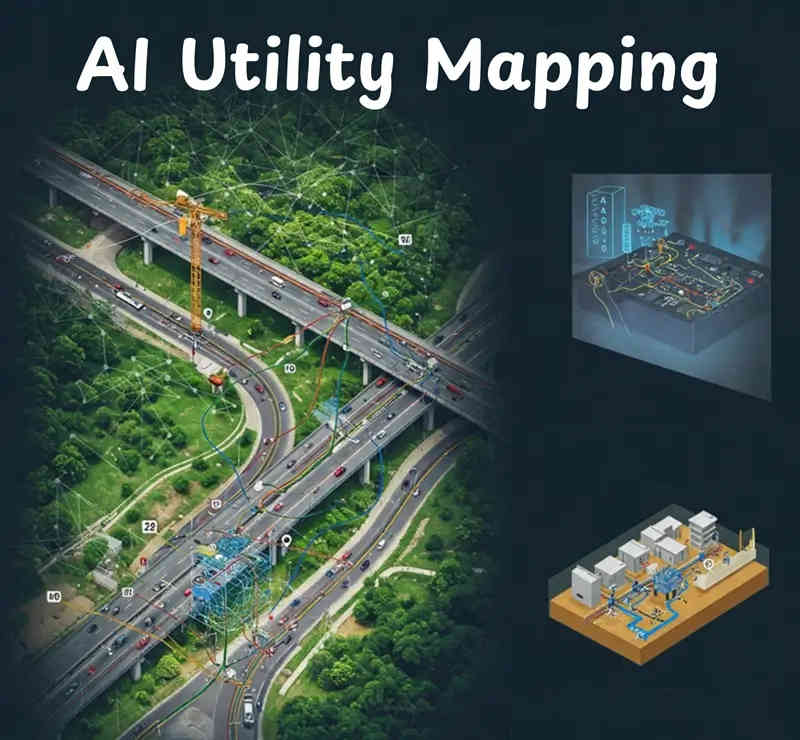
One of the most compelling developments in this digital revolution is the rise of AI Utility mapping, an approach that harnesses artificial intelligence to identify, catalogue, and manage underground utilities. By making it easier to understand a project site’s subterranean layout, AI has the potential to reduce both costs and risks, enabling civil engineers to make better decisions at every stage.
Traditional methods for locating underground pipes, cables, and other infrastructure rely on a combination of physical surveys, outdated documentation, and trial-and-error excavation. This approach is time-intensive and prone to errors, often causing unnecessary delays or leading to accidental damage to existing utilities.
Incorporating artificial intelligence into utility mapping introduces an unprecedented level of insight. Machine learning algorithms can analyze large sets of data, including geospatial information and existing utility records, to detect patterns that humans might overlook.
According to industry experts, advanced technologies in utility mapping can reduce project costs and prevent up to half of excavation-related damage. This statistic underscores how crucial precision in underground utility detection has become for modern engineering.
Civil engineering involves more than designing roads or buildings; it addresses how each project interacts with the overall environment and community. Underground infrastructure, including water mains, gas lines, telecom cables, and sewer systems, forms a hidden web that keeps cities functioning. A single error, such as striking a water main, can disrupt an entire neighborhood. Accurate utility mapping is therefore vital to minimize hazards, control disruptions, and keep costs manageable.
By gathering detailed data on what lies beneath, engineering teams can plan with fewer contingencies. If you already know where each utility is located, you have a head start on drawing up alternative routes or deciding which sections might require more complex excavation techniques. This foresight translates into smoother project management and helps preserve professional relationships, since fewer unforeseen problems arise during construction.
Gathering geospatial data is nothing new. Surveys, imaging technology, and ground-penetrating radar have been part of civil engineering for some time. The challenge lies in interpreting these data sets, which are often stored across different platforms or lack uniformity. AI transforms this challenge into an advantage. Machine learning algorithms excel at sifting through vast amounts of data, identifying relevant factors, and combining them into cohesive models.
When these models are deployed on an active construction site, they can produce near-instant updates on risk levels, highlight areas of concern, or even predict potential utility conflicts before they escalate. This isn’t just about identifying pipes in the ground; AI can analyze variables such as soil composition, local land use patterns, and historical excavation records. The result is a multi-dimensional picture of the project environment, one that merges complex data into a single point of reference.
One of the largest cost components in civil engineering is the time spent investigating, planning, and mitigating risks. Traditional utility mapping often involves repeated rounds of on-site inspections, manual record checks, and sometimes guesswork. AI has the power to accelerate this process dramatically. Rather than waiting for separate teams to gather and interpret data, a single AI-driven solution can analyze everything in parallel.
These time savings often translate directly into budget savings. Crew hours, machine rentals, and potential rework expenses all tend to drop when the project blueprint is accurate from the outset. Also, by reducing the number of physical probes or test digs, the site remains safer for workers. The synergy between time management and resource allocation can make a real difference to a project’s bottom line.
While the concept of scanning the ground for utilities isn’t new, AI amplifies what older methods can accomplish. Ground-penetrating radar (GPR) devices, for instance, send electromagnetic waves into the earth, capturing reflections that suggest the presence of an object. On its own, GPR data can be challenging to interpret, yielding ambiguities or inaccuracies. An AI model, however, can filter out irrelevant signals, adapt to different soil conditions, and even learn from prior mistakes.
Machine learning algorithms become more precise over time, incorporating fresh data from each site. This is crucial in civil engineering, because no two project environments are exactly the same. Different climates, soil conditions, and infrastructure arrangements call for flexible, adaptive solutions. An AI system that evolves with experience can continue refining how it identifies utilities, ultimately giving engineers a sharper understanding of the ground beneath.
Civil engineering projects are not solitary endeavors. They require cooperation among a range of participants: municipal authorities, architects, utility providers, financial backers, and construction crews. If any single party lacks vital utility data, it can create a bottleneck or lead to costly mistakes. AI-based utility mapping presents a unified platform where all stakeholders can access up-to-date, accurate information.
When the entire team sees the same data visualization, it reduces communication hiccups. Municipal regulators appreciate having a verified snapshot of existing infrastructure, utility providers know how their assets fit into the new project, and construction managers can plan tasks with minimal guesswork. This transparent exchange of data promotes trust and significantly cuts down on friction, leading to smoother progress throughout the project lifespan.
In an era of environmental awareness, civil engineering has a role to play in minimizing negative impacts on ecosystems. Inadvertent utility damage can lead to hazards like chemical spills or contamination of local waterways. By accurately mapping what lies underground, engineers can avoid disturbing these sensitive systems. AI doesn’t just reduce accidents; it helps project teams identify ways to design around existing resources, preserve green spaces, and limit overall land disruption.
In addition, thorough data on the subsurface can guide more sustainable decisions. If a certain area proves too risky or environmentally fragile, the team can reroute a pipeline or shift construction to a more suitable zone. Having this level of detail benefits not only the present project but can also inform future developments in the area.
Despite its promise, AI utility mapping faces hurdles. One frequent challenge is data availability. To train and run predictive models, the system needs reliable geospatial data, historical project logs, and any existing utility records. These can be scattered across multiple agencies or locked in outdated formats. The path forward is to encourage agencies and private firms to adopt more cohesive, standardized data management practices.
Another obstacle involves skepticism from seasoned professionals used to conventional methods. While experience on the ground is invaluable, AI’s capabilities complement rather than replace human expertise. Engineers who learn to integrate these tools into their workflows quickly see the advantages: consistent results and valuable insights that help them refine their own practice. Building trust in AI solutions often involves demonstration projects that illustrate tangible benefits.
The practicality of AI-based utility mapping becomes clear when looking at real projects. Many city infrastructure upgrades, such as large-scale sewer overhauls or waterline replacements, already depend on advanced mapping tools to avoid destroying older lines. By adding AI to the mix, these undertakings become more predictable, safer, and cheaper.
In some regions, adoption of these technologies has been spurred by local policies or new regulations on public construction. Once civil engineering firms see the time and cost savings in action, it becomes difficult to return to manual methods. The synergy between data-driven planning and day-to-day construction operations fosters a new standard that puts reliability first.
As AI algorithms continue to improve, and as data sets grow in both quantity and quality, the capacity to detect smaller or deeper utilities may expand. Over time, the entire pipeline of a civil engineering project— from feasibility studies to final inspections— could rely on a single integrated system that merges 3D site models, real-time sensor readings, and AI-based simulations. With the right data, future algorithms might even predict how utilities will shift or degrade over time, proactively alerting teams before a problem emerges.
This proactive approach is poised to revolutionize asset management within civil engineering. Utility lines are no longer treated as static structures but as dynamic elements. If the AI system flags a portion of pipe for potential failure, maintenance crews can address it before it escalates into a break or outage. Such an evolution in operations could save cities millions of currency units each year and improve overall infrastructure reliability.
The shift toward AI Utility mapping signals a new era for civil engineering, one where advanced data analytics and machine learning produce a deep, accurate understanding of subsurface elements. By combining existing geospatial datasets with AI-driven processing, engineers can plan projects around hidden utilities with unprecedented precision. This transformation is grounded not just in technology but also in a cultural acceptance that data-driven insights empower human expertise rather than displacing it.
Real-time access to high-fidelity underground maps makes construction sites safer, shortens project timelines, and fosters greater collaboration among stakeholders. The sustainability angle cannot be overlooked, as more precise excavation cuts down on wasted materials and protects natural resources. Meanwhile, the approach to maintenance evolves from reactive to proactive, sparing communities from disruptions caused by catastrophic utility failures.
Though challenges remain, including data standardization and the need to earn trust from industry veterans, the benefits are enormous. AI is reshaping how we view the subterranean world, turning utility mapping from an afterthought into a vital element of project design. The promise of lower risks, cost savings, and robust, data-driven insights is setting a standard that will likely define civil engineering’s future. As technology matures, we can expect AI utility mapping to become a staple of every major project, ensuring that engineers, city planners, and local communities all share a deeper understanding of what truly lies beneath.
Find the best Professionals and companies nearby you on KreateCube .
Get QuoteStay updates with latest leads, subscribe now!
Stay updated with latest diy home improvement tips, subscribe now.
Real Estate
26-Mar-2024
Building Information Modeling (BIM) is a digital technology that has revolutionized the construction industry. It allows for the creation of 3D models that contain all the information needed for a building project, from design to construction...
Read MoreReal Estate
27-Jan-2024
As we progress deeper into the 21st century, the incorporation of groundbreaking technologies is transforming the landscape of construction machinery. From artificial intelligence to robotics and automation, emerging trends are redefining how...
Read MoreReal Estate
16-Dec-2023
Today, we’re stepping into an amazing era where smart software joins hands with eco-friendly building methods. It’s an exciting combo that’s reshaping so many aspects of our construction world. Let’s explore how this tech isn’t just a fancy term.
Read More
Leave Your Comment